


pouzenc

orsel
User GUIDE
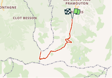

Length
14.8 km

Max alt
2845 m

Uphill gradient
1187 m
Km-Effort
31 km

Min alt
1662 m

Downhill gradient
1189 m
Boucle
Yes
Creation date :
2024-08-08 05:56:41.493
Updated on :
2024-08-10 05:39:04.709
6h54
Difficulty : Medium

FREE GPS app for hiking
 SityTrail
IGN / Geographical institutes
SityTrail Plus
The world is yours!
About
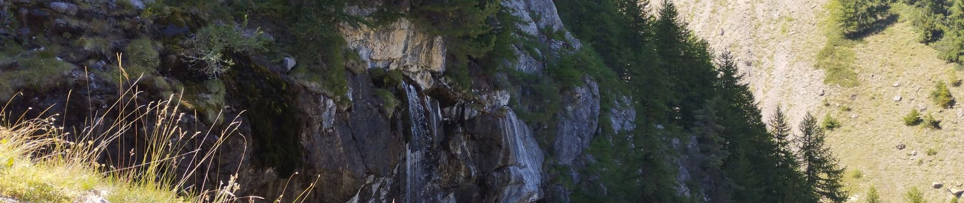
Trail Walking of 14.8 km to be discovered at Provence-Alpes-Côte d'Azur, Hautes-Alpes, Les Orres. This trail is proposed by orsel.
Photos

Positioning
Country:
France
Region :
Provence-Alpes-Côte d'Azur
Department/Province :
Hautes-Alpes
Municipality :
Les Orres
Location:
Unknown
Start:(Dec)
Start:(UTM)
305222 ; 4928647 (32T) N.
Comments